

Nexys by Exyn is a fully modular 3D mapping and autonomous navigation solution designed to deliver fast, survey-grade geospatial data capture in the most challenging environments. Powered by Exyn’s advanced SLAM-based LiDAR technology and proprietary autonomy software, Nexys enables accurate mapping in GPS-denied, hazardous, underground, and low-visibility conditions without requiring a pilot.
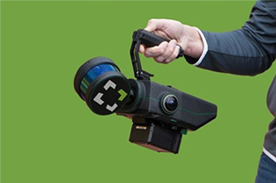
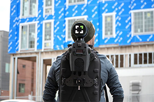
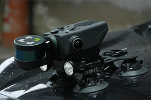
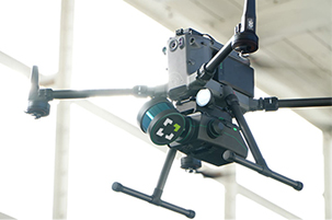
Its flexible architecture allows seamless deployment as a handheld scanner, backpack system, aerial drone payload, ground robot integration, or custom platform, giving organizations a single solution for multiple mapping and inspection workflows. With real-time visualization, rapid on-site processing, and seamless interoperability with industry-standard software, Nexys helps improve safety, reduce operational downtime, and accelerate decision-making across mining, infrastructure, industrial, and energy applications.
Up to 1.9 million scan points per second.
±2 cm on Nexys,
±5 mm on NexysPro.
High-resolution LiDAR for exceptional detail.
Designed to withstand harsh environments, including dust and moisture.
A completely modular 3D mapping solution designed to reduce time to capture, increase safety, and drive efficiency for challenging, complex, or dangerous environments.
See your data in action. Nexys delivers real-time, high-detail visualization with colorized mapping so you can verify the completeness of your scans before leaving the site. ExynView, our proprietary software, ensures fast and seamless data capture and post-processing, streamlining your workflows.
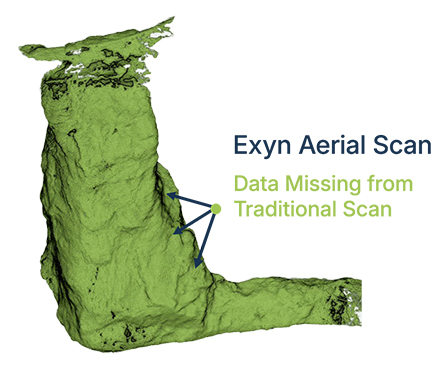
With its SLAM-based spatial mapping, Nexys excels in dynamic environments. It captures up to 1.9 million data points per second with precision levels of ±2cm on Nexys and ±5 mm on Nexys Pro. Continuous updates ensure accurate, up-to-date maps with every step.
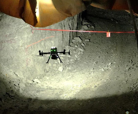
Nexys is engineered to adapt. From indoor to outdoor environments, underground to long-range missions, autonomous or piloted operations, and even in network-denied conditions, Nexys delivers results. Its modular design allows you to switch configurations effortlessly, and the custom interface guide lets you create unique applications tailored to your needs.
Industries that demand precision & adaptability turn to Nexys
3D maps, sensor data, and georeferenced models to the mining industry
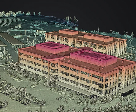
It captures survey-grade 3D maps of construction sites in progress.
Featuring fast capture of survey grade data, post processing in the field for real-time visualization
Economical, and precise approach to data gathering across a range of needs
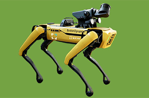
Autonomous robotic systems for GPS- and comms-denied environments
We are dedicated to revolutionizing aerial technology with innovative solutions tailored for Industrial Inspection, Risk Assessments, Insurance catering to Cement, Power Plant, Chemicals, Oil & Gas, Marine Vessels, Mining and Infrastructure.

© 2025 SKYSCOUT SOLOUTIONS. All Rights Reserved.